


Professional Land Survey Services for Better Site Data Today
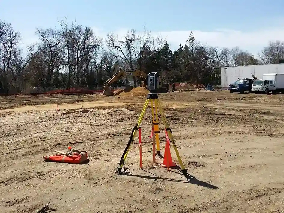
How Can Professional Land Surveying Services Give Builders Better Site Information?
AI OverviewProfessional land surveying services give builders site information about property boundaries, elevations, existing structures, terrain, drainage patterns, and other physical conditions. This information supports site design, construction layout, grading, permitting, subdivision work, and land development decisions. By comparing field observations with plans and records, survey data can show where site conditions differ from assumptions. That can help project teams address conflicts before they affect construction. |
Introduction
A building plan can look complete on paper and still miss a problem sitting in the field. A property line may differ from an old drawing. An elevation may not match the design basis. An existing structure, utility feature, or drainage path may sit where the project team did not expect it. These gaps create more than paperwork issues. They can force layout changes, delay excavation, trigger redesign, or create disputes over property rights.
The risk grows when teams treat survey information as a one-time requirement instead of a source of current site evidence. Professional land surveying services give builders a field-based record that can be checked against plans, deeds, prior surveys, and design information. That connection between records and physical conditions forms the basis for better site decisions. Early site facts give teams more room to adjust design, sequencing, budgets, and field operations before construction work begins.
Existing Conditions Need More Than A Plan
A construction drawing describes intended work, while a survey describes conditions that exist on the ground. The difference matters. Professional land surveying services can establish property lines, locate visible site features, record elevations, and document structures or improvements that affect design. Surveyors may also review deeds, maps, easements, prior records, and other evidence before fieldwork begins. For builders, the value is not simply a set of points on a drawing. It is a defensible site record that helps engineers and contractors understand the relationship between proposed work and the property as it exists.
In land use planning and development, this information can support decisions about site layout, access, setbacks, grading, drainage, and parcel limits. The field baseline should be established before major site decisions are fixed. Professional land surveying services can connect control points, boundary evidence, elevations, and visible improvements to the project coordinate system. This gives the design team a common reference for later layout and verification. A field observation without record research can leave important questions unanswered, so surveyors may compare deeds, plats, easements, municipal records, and earlier surveys to determine whether a condition has legal or historical significance. That context matters when a fence, wall, driveway, or structure appears close to a boundary.
Survey Data Can Expose Design Conflicts Early
Site information becomes more useful when teams compare it with the design rather than viewing it in isolation. Professional land surveying services can help identify differences between planned and existing elevations, building footprints, boundary locations, and visible site features. A small discrepancy may have a large effect when it occurs near a setback, foundation line, drainage path, or access point.
The issue is not limited to boundaries. Differences in ground elevations can affect cut and fill quantities, drainage direction, foundation design, accessible routes, and finished floor levels. Existing improvements can also create conflicts when their locations differ from design assumptions.
Consider a proposed building that sits near a property line. If the boundary evidence differs from the assumption used during design, the issue can affect setbacks, zoning review, foundation placement, and construction layout. During development planning, early comparison of survey information with proposed plans can reduce the chance that a field conflict appears after excavation or structural work has started.
Key checks often include:
-
Property boundaries and monuments
-
Existing buildings, walls, fences, and driveways
-
Ground elevations and grade changes
-
Drainage features and low areas
-
Visible utility structures and site improvements
-
Setbacks, access points, and easement areas
The main benefit is timing. Finding a conflict during planning usually gives the team more options than finding it after materials are ordered or work is underway. Professional land surveying services therefore serve as an information checkpoint between site investigation and construction execution.
Better Site Control Supports Field Execution
Construction depends on a shared reference system. Professional land surveying services can establish or verify control points used for building layout, grading, foundation work, utility placement, and other field activities. When design information and field control use the same reference, crews have a clearer basis for checking whether installed work matches plans.
Control is especially important on projects with several trades working from the same plans. A stable reference allows survey crews to set out building corners, column lines, grades, offsets, and other locations needed by field teams. Repeated checks can also show whether site movement or construction activity has affected previously established points. For larger sites, survey control can support staged construction, allowing teams to verify a portion of the work before moving to the next phase. It suits high-rise work, additions, complex grading, and tight property constraints.
For larger sites, useful field checks can include:
-
Building corners and column lines
-
Foundation lines and offsets
-
Finished and working grades
-
Utility locations tied to project control
-
Key points checked before later work covers them
The result is better communication between the design office and the field. Instead of relying on assumptions or informal measurements, crews can work from documented control and site information.
Survey Data Supports Land Development Decisions
Survey Inputs Shape Early Development Choices
Land development involves decisions about a parcel before construction begins. Professional land surveying services provide information that can affect the layout of lots, roads, access routes, building areas, drainage features, and required setbacks. For land use planning and development, survey information can also support subdivision mapping, site planning, and review of existing conditions.
Site Constraints Need A Common Reference
The quality of these decisions depends on the relationship between field evidence and project requirements. A parcel may appear suitable for a proposed layout until boundary constraints, elevation changes, easements, or existing improvements are considered. A survey gives the design team a factual basis for testing those constraints before plans advance.
Construction Verification Keeps Site Work On Track
Once construction starts, survey information remains useful as a reference for field checks. Professional land surveying services can support verification of building locations, grades, foundation lines, structural points, and other elements that must correspond with the approved design. These checks can be scheduled at key stages rather than treated as a single inspection event.
Verification also creates a record of what was checked and when. On complex projects, that record can help project managers compare field conditions with design information, coordinate different crews, and identify a problem before later work covers the area. The process is particularly useful where several construction phases depend on the same reference points.
Project Records Keep Survey Findings Usable
A survey becomes more useful when its findings remain clear to everyone who depends on them. Professional land surveying services can produce plans, field notes, control information, and related records that give project teams a shared source of site data. Clear documentation also helps teams trace a decision back to its supporting information.
For land use planning and development, maintaining survey records can help when a project changes scope, adds a new phase, or requires later review. Older information should not automatically be treated as current, but it can provide context when compared with new field observations. Teams can then separate usable records from information that needs fresh verification.
Conclusion
Paper plans have limits. The ground does not. Professional land surveying services give builders a documented view of boundaries, elevations, structures, and other conditions that can affect design and field work. That information becomes especially useful when it is checked against plans, property records, and construction control.
That record matters greatly. For teams involved in land use planning and development, the survey can also serve as an early decision point before commitments are made. Much like professionals who work with resources such as Ferrantello Group, project teams benefit from treating survey information as technical evidence rather than a box to check. The stronger the site record, the clearer the basis for planning, layout, and construction decisions.
Frequently Asked Questions (FAQs)
1. What do professional land surveying services provide builders?
They provide field information about boundaries, elevations, structures, visible features, and other existing site conditions.
2. How does surveying support land use planning and development?
It provides site facts that help teams assess parcel limits, access, setbacks, grading, drainage, and subdivision conditions.
3. When should a builder order a land survey?
A survey is generally most useful before design and construction decisions depend on site conditions.
4. Can survey information help identify construction conflicts?
Yes, professional land surveying services can reveal differences involving boundaries, elevations, structures, and site features.
5. Can survey data help with construction layout?
Yes, survey data can provide control points and site references for locating foundations, building lines, grades, and other construction elements.